Professional Topographical Surveys for Planning, Design and Construction
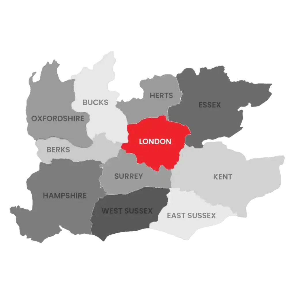
XP Surveys provides professional topographical surveys and detailed site plans for planning, design and construction projects across London, the Home Counties and the wider UK. Our experienced topographical surveyors work across residential, commercial and infrastructure projects.
Also referred to as a topographic or topo survey, a topographical survey records the land levels, contours, boundaries and site features your project needs for planning applications, drainage design and construction coordination. New to topo surveys? Read our guide to what a topographical survey is.
Request an instant quote for a bespoke topographical survey.
What Our Topographical Surveys Include
Every survey is tailored to your site conditions and project brief.
- Ground levels & spot heights Terrain levels across the site
- Contours Contours to a specified interval
- Boundaries Visible boundary features
- Buildings & structures Footprints of buildings on and around the site
- Retaining walls Walls and level changes
- Access routes & kerblines Roads, paths and kerbs
- Hard landscaping Surfaces and external works
- Trees & vegetation Trees and planting
- Drainage Drainage infrastructure and cover levels
- Service covers Utility and service covers visible at the surface
The exact features and level of detail are agreed in your quotation. A topographical survey records visible surface features: it does not determine legal boundaries, and underground services are not traced as part of a standard topographical survey.
CAD-Ready Topographic Survey Data for Complex Sites
Our topographical surveys deliver far more than a basic site plan. From site contours and drainage paths to retaining walls, utility covers, access routes and hard landscaping, every dataset is captured with advanced laser scanning and robotic total stations, then processed into CAD-ready drawings and scaled digital terrain models that integrate directly into AutoCAD, Revit and ArchiCAD workflows.
Our nationwide survey teams regularly support infrastructure, residential and commercial developments across London and the wider UK, giving architects, engineers and developers a dependable foundation of terrain data from the earliest stages of a project.
Levels, Contours and Digital Terrain Models
Measured levels become spot-level plans, contour drawings and scaled digital terrain models that integrate directly into AutoCAD, Revit and ArchiCAD workflows.
- Spot levels Individual measured ground heights, shown on the drawing at the points where they were taken.
- Contours Lines joining points of equal height, generated from the measured levels at an interval specified for the project.
- Digital terrain model (DTM) A 3D surface of the ground built from the measured levels, used for design, drainage and earthworks.
- Survey control Fixed reference points tied to GNSS, so every measurement sits in one consistent coordinate system.
Why Accuracy Matters
The cost of inaccurate terrain data rarely shows up until it’s expensive. Incorrect levels lead to drainage designed for falls that don’t exist on site. Missed features surface as clashes during construction coordination.
Earthworks calculated from unreliable contours mean mispriced groundworks and planning submissions built on flawed site data invite delays, objections and redesign costs that far exceed the price of the survey itself. Getting the terrain data right at the outset is the cheapest risk reduction a project can buy.
Our Surveying Technology & Equipment
We use the latest technology to capture land data and features accurately, including the Trimble X9 & X7 3D Laser Scanner and the Leica TS16.
Leica TS16 robotic total station
Measures individual points, levels and features precisely across the site.
Trimble X9 & X7 3D laser scanners
Capture dense 3D data of complex areas, buildings and structures.
GNSS survey control
Ties the survey to fixed control so every drawing shares one coordinate system.
Drone capture
Available for large or hard-to-access sites.
Survey Accuracy & Quality Assurance
Site data is checked against control observations before processing, and every drawing passes internal quality assurance before delivery.
Instruments are selected to suit each site, so not every survey uses every instrument. The accuracy achievable on your site depends on the survey control, site conditions, method and level of detail required, and is agreed in your quotation.
Need wider coverage? See our drone surveys and point cloud surveys.
Who Needs a Topographical Survey?
Architects, developers and engineering teams rely on XP Surveys for planning-ready topographical survey data that identifies site constraints, level changes and coordination challenges before projects progress into detailed planning and construction, minimising redesign and reducing risk during design development.
- Architects and planning consultants to support feasibility studies, terrain analysis and design development
- Engineers and contractors for drainage coordination, excavation planning and groundworks
- Developers preparing pre-acquisition assessments and planning submissions
- Local authorities delivering urban regeneration and infrastructure improvements
Beyond design teams, landowners and purchasers use our surveys to obtain reliable area calculations and site intelligence that support valuation, acquisition due diligence and long-term development planning.
Applications of Land Surveys in Planning and Development
Topographical surveys play a critical role in planning, design and construction by providing accurate terrain and site data at the earliest project stages. By capturing detailed land levels, surface features and site constraints, these surveys enable architects, developers and engineers to make informed decisions with confidence and reduce risk throughout the project lifecycle.
- Urban planning strategies and zoning assessments
- Residential, mixed-use and commercial development projects
- Infrastructure schemes including highways, rail and utility networks
- Flood risk analysis and drainage design coordination
- Landscape architecture, external works and ground modelling
- Recording visible boundaries to support boundary and land ownership discussions
- Environmental and ecological impact planning
- Planning applications and building regulation submissions
How Much Does a Topographical Survey Cost?
The cost of a topographical survey depends on site size, the level of detail required and access conditions.
- Site size and complexity Larger sites and complex urban environments require longer capture and processing times
- Level of detail A boundary-and-levels topo costs less than a full-detail survey recording every visible feature
- Access conditions Restricted access, dense vegetation or live traffic environments extend survey time
- Whether drone capture or laser scanning is needed
- Turnaround requirements and output formats
Why do topographical survey prices vary so much?
The two biggest factors are site size and detail level. A survey recording boundary outlines and basic ground levels takes far less field and processing time than a full-detail topo capturing every kerbline, tree, service cover and level across a development site. Access restrictions and expedited turnaround also affect the price.
Rather than generic estimates, we provide clear, fixed quotes tailored to your site. Use our instant quote tool to receive a fast, competitive price in minutes — for larger or more complex sites, our team will provide a detailed proposal outlining costs, timescales and deliverables.
To minimise costs, define your scope clearly upfront knowing exactly which features and levels you need to record, which avoids unnecessary survey time. You can also use Google Earth to indicate the extent of land and features required before requesting a quote.
Our Topographical Survey Process
Our land surveyor visits the site and sets up specialised measuring equipment, recording the heights and distances between land features. This gives the surveying team the coordinates required to create a detailed map of the land, output in AutoCAD (.dwg), Revit (.rvt) or PDF format.
- Enquiry and survey brief You provide the site details and requirements.
- Quotation and survey planning The project scope, required accuracy, deliverables and access arrangements are agreed.
- Site measurement Surveyors capture the agreed site features and levels.
- CAD drawings and digital outputs The measured data is processed, checked and supplied in the agreed formats.
Time on site
Most residential and small commercial sites are completed in a single day. Larger or more complex sites may require two or more days on-site.
Drawing delivery
Delivery of the CAD drawings and digital outputs is confirmed in your quotation, based on the site and deliverables agreed.
Topographical Survey Deliverables & Technical Outputs
Just let us know what program you or your architect works in, and we will supply you with your survey drawings in the desired format — including 2D AutoCAD (.dwg), DXF, PDF, Revit (.rvt) and ArchiCAD.
| Deliverable | Available |
|---|---|
| 2D AutoCAD (.dwg) | ✓ |
| DXF | ✓ |
| PDF survey plans | ✓ |
| Revit (.rvt) 3D models | ✓ |
| ArchiCAD | ✓ |
| Point cloud data | ✓ |
| Digital terrain model (DTM) | ✓ |
| Contours to specified interval | ✓ |
| Spot levels | ✓ |
| XYZ coordinate exports | ✓ |
Just tell us which program you or your architect works in and we’ll structure the survey drawings to suit your workflow.
The outputs included in your survey are agreed in your quotation.
Measured Survey vs Topo Survey
Topographical survey
Relates to land: levels, contours and site features.
Measured building survey
Relates to a building: floor plans, elevations and internal dimensions. See our measured building surveys.
Many projects require both, and XP Surveys provides both services in-house. For a full comparison, see our guide to topographical vs measured surveys.
Recent Topographical Survey Case Studies
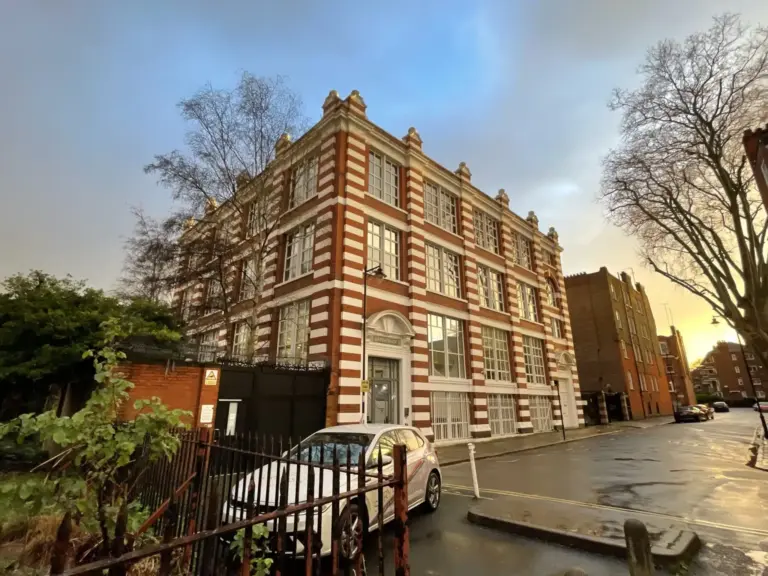
Greenpeace UK Headquarters, London
A constrained urban site in Islington with no existing records of the premises. Our topographical survey captured the site around the four-storey office and warehouse buildings’ boundaries, external levels and surrounding features, so the client could begin design discussions with their architect from a complete picture of both land and buildings.
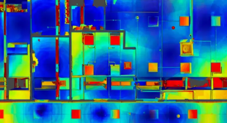
Wexham Park Hospital, Slough
A live healthcare estate where survey work has to fit around clinical operations. Alongside internal survey works, our team carried out a topographical survey of the site’s external ground levels, access routes and drainage cover levels around the works area to give the project team reliable external level data for coordinating the works.
Typical Topographical Survey Projects
- House extensions and residential plots
- New build and housing developments
- Commercial developments and mixed-use schemes
- Industrial estates and logistics sites
- Schools and education estates
- Healthcare sites
- Highways and utility infrastructure
- Heritage settings and constrained urban sites
Why Architects & Developers Choose XP Surveys
- Survey-grade instruments and GNSS survey control
- Instant online quote — fixed price in under a minute
- UK-wide coverage from nationwide survey teams
- Drone surveys available for large or hard-to-access sites
- Revit, AutoCAD and ArchiCAD outputs structured to your layers
- Experienced surveyors supporting earthworks, drainage, utility and tree protection strategies
Topographical Survey FAQs
What is the purpose of a topographical survey?
It helps professionals understand a site’s existing conditions. A topographical survey is used to assess feasibility, support planning applications, and inform site design decisions by identifying levels, boundaries, drainage paths and any constraints on the land.
What does a topographical survey include?
Land levels, contours, visible boundaries and site features such as buildings, retaining walls, access routes, hard landscaping, trees, drainage and service covers. The exact scope is agreed in your quotation. Read more in our guide to topographical surveys.
How much does a topographical survey cost?
The price depends on site size, access conditions and the level of detail required. Use our instant quote tool for a fixed price in under a minute, or contact us directly for larger or more complex sites.
How accurate is a topo survey?
A professionally conducted topo survey can achieve accuracy within millimetres. At XP Surveys, we use advanced instruments including 3D laser scanners and total stations to ensure high precision across every project.
The accuracy for your site is agreed in your quotation.
How long does a topographical survey take?
Most residential and small commercial sites are completed in a single day. Larger or more complex sites may require two or more days on-site.
Delivery of the drawings is confirmed in your quotation.
Do I need a topographical survey for planning permission?
Planning applications and building regulation submissions commonly rely on accurate site levels and features. A topographical survey provides that information, so planning drawings are based on the site as it exists.
What files will I receive?
Outputs can include 2D AutoCAD (.dwg), DXF, PDF survey plans, Revit (.rvt) 3D models, ArchiCAD, point cloud data, a digital terrain model, contours, spot levels and XYZ coordinate exports. The formats for your survey are agreed in your quotation.
Can XP Surveys provide 3D models from the survey?
Yes. We can generate 3D topographic models suitable for design workflows or visualisations in Revit or ArchiCAD, depending on your project requirements.
What’s the difference between a topographical survey and a land registry plan?
A topographical survey provides detailed elevation and surface feature data — levels, contours, drainage and site constraints. A land registry plan simply outlines legal property boundaries, typically with far less accuracy and no terrain information.
What is the difference between a topographical survey and a measured building survey?
A topographical survey covers land — levels, contours, boundaries and site features. A measured building survey covers buildings floor plans, elevations and internal dimensions. Many projects require both, and XP Surveys provides both services in-house.
Is a cheap topographical survey worth the risk?
Inaccurate terrain data is one of the most expensive mistakes a project can absorb — drainage designed to wrong levels or planning drawings based on incorrect boundaries cost far more to fix than the survey itself. Every XP Surveys topo is captured with survey-grade instruments and delivered as CAD-ready drawings your design team can rely on.
What areas do you cover?
We provide topographical surveys throughout Greater London and the Home Counties, including Surrey, Essex, Kent and Hertfordshire. Searching for a topographical survey near you? Our teams cover projects nationwide — contact us to discuss your location and requirements.